Product Details
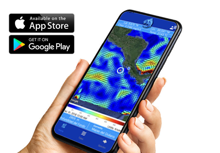
- Access near real time maps of satellite data for the Atlantic and Pacific Oceans
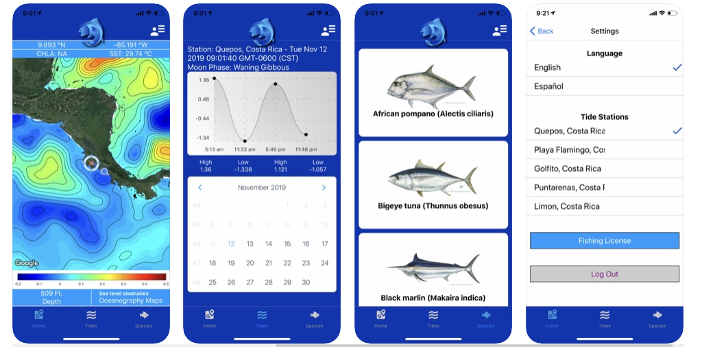
along Central America (1-20°N, 76.5-96°W). - View the bathymetry and get bottom depth readings.
- Overlay high-resolution satellite sea surface temperature and surface
chlorophyll concentrations and get data for your points of interest, even while
offline. - View maps with the latest speed and direction of the ocean currents, the depth
of the thermocline, and sea level anomalies. - Access forecasts for tides and moon phases.
- Review facts on the most common fish species in the region, including sizes, reproductive periods, and fishing information.
- Review local laws and regulations.
- Purchase your Costa Rica sport fishing license online
- Stay up to date on everything that’s happening with real-time notifications of
weather events, red tides, fishing bans, tournaments, etc.
Satellite Data Details
 1. Sea surface temperature – (in degrees Celsius or Fahrenheit) produced from MODIS Aqua data with a 2 km/pixel daily resolution. Values represent a 5-day rolling-mean of the current plus 4 previous days. Data distributed by NASA’s Ocean Biology Processing Group.
2. Surface chlorophyll concentration (In mg/m3 ) produced from MODIS Aqua data with a 2 km/pixel daily resolution. Values represent a 5-day rolling-mean of the current and 4 previous days. Data distributed by NASA’s Ocean Biology Processing Group.
3. Sea Level Anomaly (in meters or feet) Updated daily from multiple altimetry observations with a resolution of 25 km/pixel. It represents the deviation in ocean elevation from the mean circulation and is useful to identify structures such as eddies. distributed by E.U. Copernicus Marine Service Information.
4. Depth of the Mixed Layer (in meters or feet) produced daily with data from the Operational Mercator Global Ocean Analysis and Forecast System with a spatial resolution of 9 km/pixel. It is used to indicate the depth immediately above the thermocline. Data distributed by E.U. Copernicus Marine Service Information.
5. Surface currents speed (in knots, shaded) and direction (black arrows) are produced from OSCAR data with a spatial resolution of 37 km/pixel and updated every 5 days. Values represent the mean of a 5-day period. Data reference: ESR. 2009.OSCAR third degree resolution ocean surface currents. Ver. 1. PO.DAAC, CA, USA. http://dx.doi.org/10.5067/OSCAR-03D01.
We hope you enjoy your Costa Rica fishing adventures using Pezca

Acknowledgements
Agradecimientos
For more information about Costa Rica fishing visit www.fecop.org | designed by Osa Fishing Trips